Reporting by Jennifer Cortez, Palm Springs Desert Sun
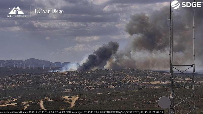
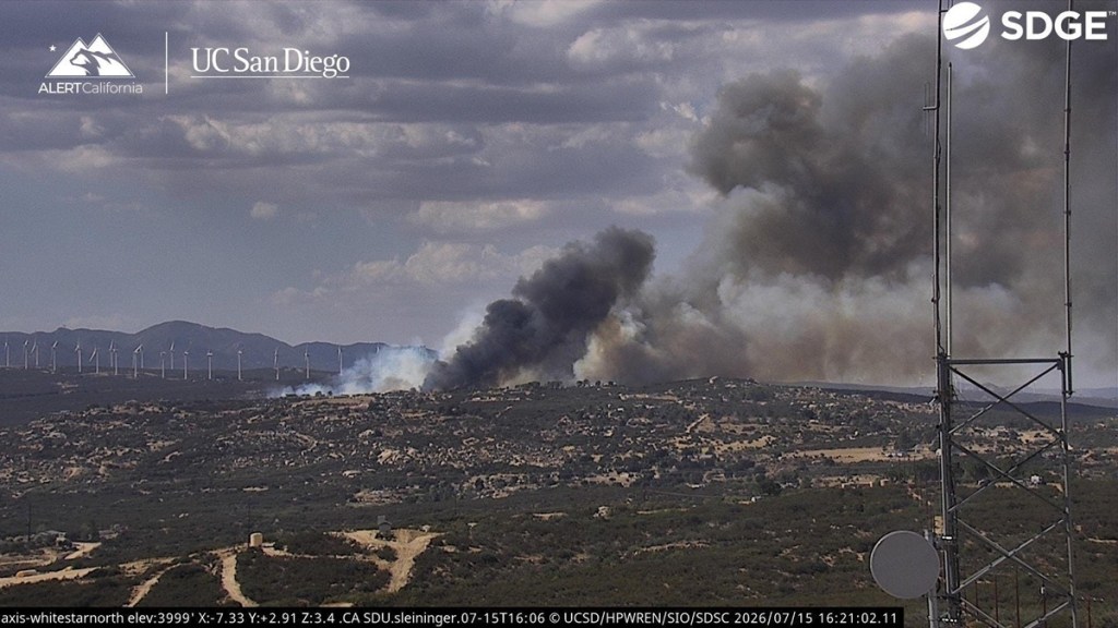
A wildfire near Campo, an unincorporated community near the U.S.-Mexico border in San Diego County, quickly grew to 750 acres Wednesday evening and crossed Interstate 8, threatening structures and prompting evacuations, according to Cal Fire.
The Thorn Fire was reported July 15 near 2500 Buckthorn Trail, close to Clover Trail. It expanded from an initial 8 to 10 acres to 50 acres and crossed Interstate 8 by 5 p.m., and was 0% contained by 9:45 p.m.
The fire continues to burn at a moderate to dangerous rate of spread, and it poses an immediate threat to structures, Cal Fire’s San Diego Unit said.
About 130 San Diego Gas & Electric customers near Live Oak Springs were without power as of 3:43 p.m., with service expected to be restored by 9 p.m.
Incident commanders requested 10 engines, four hand crews and two bulldozers, according to Watch Duty, a free app that offers free real-time wildfire updates by drawing from firefighters’ radio traffic and other sources. Two additional air tankers and a helicopter were also requested.
The cause of the fire is under investigation.
Thorn Fire evacuations
Evacuation orders and warnings remained in effect for the Thorn Fire as of 6:49 p.m. Wednesday.
The following zones were under evacuation orders:
- SDC-2174: North of Williams Road; south of Old Mine Road; east of Tusil Road; west of Bureau of Indian Affairs Road 14
- SDC-2175: North of Tecate Divide; south of Bureau of Indian Affairs Road 14; east of Williams Road; west of Bureau of Indian Affairs Road 14
- SDC-2176: North of Clements Street; south of Bureau of Indian Affairs Road 14; east of Bureau of Indian Affairs Road 14; west of Ribbonwood Road
- SDC-2331: North of Old Highway 80; south of Hi Pass Road; east of Old Highway 80; west of Tierra Heights Road
- SDC-2332: North of Old Highway 80; south of Camino Del Mesa and Hi Pass Road; east of Tierra Heights Road; west of Ribbonwood Road
- SDC-2333: North of Hi Pass Road; south of Clements Road; east of Opalocka Road; west of Ribbonwood Road
- SDC-2334: North of Mccain Valley Road; south of Sacotone Overlook and Mccain Valley Road; east of Mccain Valley Road; west of Mccain Valley Road
- SDC-2241: North of Paso Alto Court; south of Williams Road; east of Williams Road and Old Highway 80; west of Camino Del Mesa and Paso Alto Court
- SDC-2242: North of Ribbonwood Road and Roadrunner Lane; south of Ribbonwood Road; east of Ribbonwood Road; west of Mccain Valley Road
- SDC-2243: North of Rocky Knoll Road and Four Cs Ranch Road; south of Mccain Valley Road; east of Roadrunner Lane and Ribbonwood Lane; west of Mccain Valley Road
- SDC-2244: North of Mccain Valley Road, Blm and Sacotone Overlook; south of Mccain Valley Road; east of Mccain Valley Road; west of Blm
Evacuation warnings, which indicate a potential threat to life and property, were also issued for the following zones:
- SDC-2117: North of Bureau of Indian Affairs Road 14 and Ribbonwood Road; south of Blm 128; east of Manzanita-Cottonwood Road and Hubble Road; west of Lost Valley Road
- SDC-2177: North of Mccain Valley Road; south of Mccain Valley Road; east of Ribbonwood Road; west of Blm 073 and Mccain Valley Road
- SDC-2245: North of Blm; south of Sacotone Overlook; east of Blm and Sacotone Overlook; west of Blm
- SDC-2335: North of Mccain Valley Road; south of Blm; east of Mccain Valley Road and Old Highway 80; west of Desert Rose Ranch Road
- SDC-2408: North of Old Highway 80; south of Rocky Knoll Road; east of Ribbonwood Road and Old Highway 80; west of Old Highway 80 and Mccain Valley Road
- SDC-2410: North of Old Highway 80; south of Mccain Valley Road; east of Mccain Valley Road and Old Highway 80; west of Hwy 8
Evacuation zones can change quickly during a wildfire. Residents can use Genasys Protect at protect.genasys.com or through its mobile app to monitor real-time emergency alerts. To better understand an evacuation zone, tap it on the map to see the streets and landmarks used to define the warning or order.
A temporary evacuation point has been established at the Golden Acorn Casino, located at 1800 Golden Acorn Way in Campo.
Thorn Fire road closures
Interstate 8 is closed in both directions until further notice, according to Cal Fire.
Drivers were advised by the California Highway Patrol to use Old Highway 80 as an alternate route and use caution as emergency vehicles and fire responders accessed the fire.
Thorn Fire weather report
An extreme heat warning remained in effect until 8 p.m. Thursday for the San Diego County mountains and valleys. The National Weather Service forecast highs from the mid-90s to 102 degrees in the valleys and overnight lows in the upper 60s and lower 70s.
A smoke advisory was also issued for Live Oak Springs, Boulevard, Tierra del Sol, McCain Valley and nearby communities in southeastern San Diego County.
Smoke from the Thorn Fire was expected to move east and south Wednesday evening, with winds expected to ease overnight. Winds could shift early Thursday and carry the smoke north, the San Diego County Air Pollution Control District said.
Air quality in areas with heavy smoke could range from unhealthy for sensitive groups to unhealthy for everyone. Residents who smell smoke should limit their outdoor activity and remain indoors when possible — especially children, older adults and people with heart or respiratory conditions.
This is a developing story.
Jennifer Cortez covers education and breaking news in the Coachella Valley. Reach her at jennifer.cortez@desertsun.com.
This article originally appeared on Palm Springs Desert Sun.
Related: CoreCivic sells two CA detention centers to DHS for $1.5 Billion